Everything needed to maintain a consistent visual record across your portfolio.
Structured Job Portal
Every capture is delivered into the same organized portal — grouped by property and date. No scattered folders or guessing which link is the latest. Each visit is processed, structured, and quality-checked before it becomes part of the record.
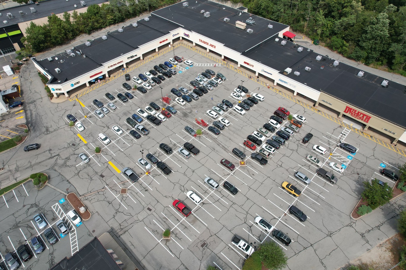
Orthomosaics
A full-site, high-resolution view of the entire property at once. See roofs, pavement, drainage, and layout without switching between individual photos.
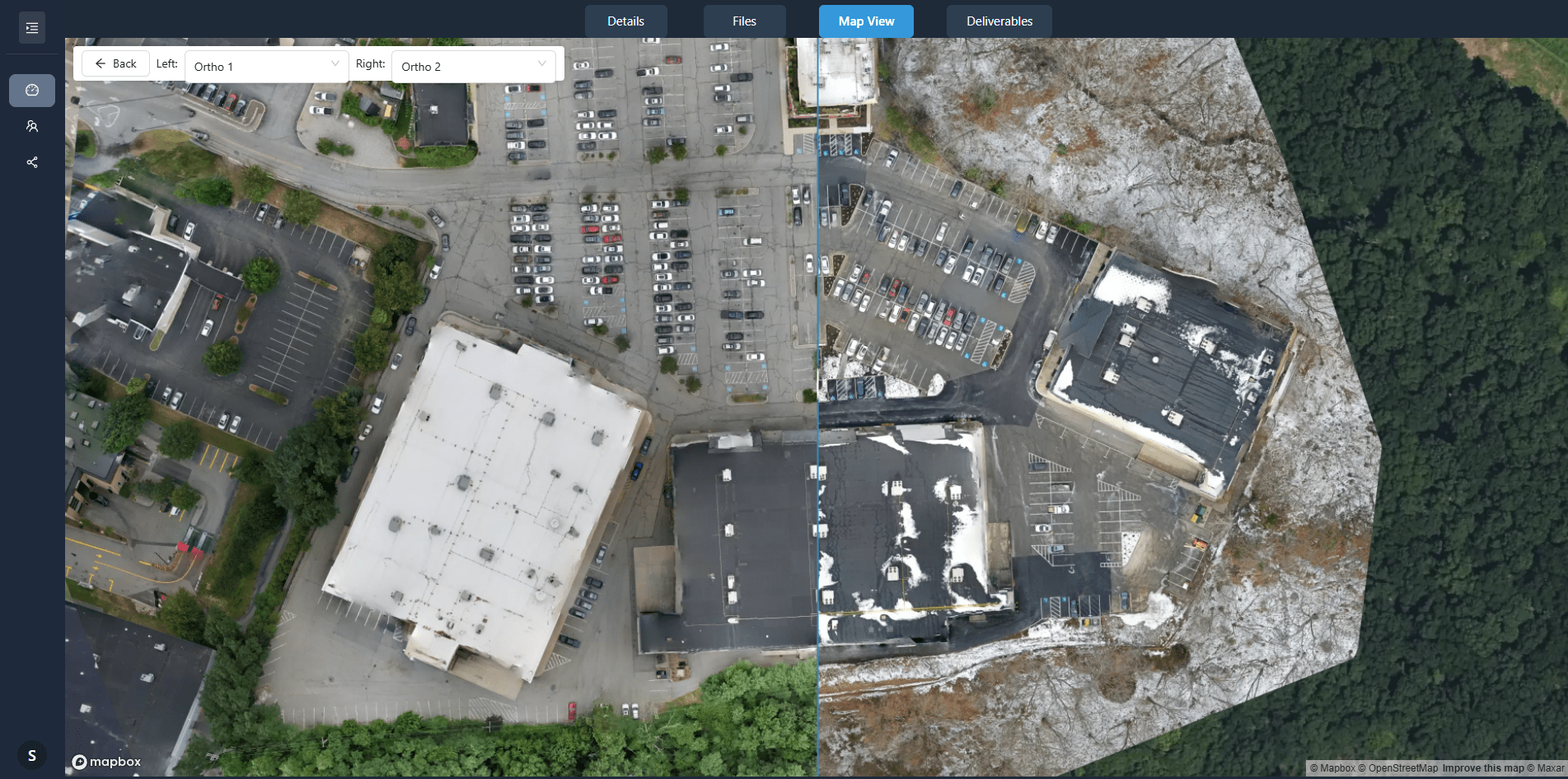
Side-by-Side Comparison
Select two dates and view them together. Spot changes in roofing, façade, pavement, landscaping, or site conditions clearly.
Map-Based Browsing
Navigate by property and location, not by file name. Jump directly to the area you need without opening dozens of images.
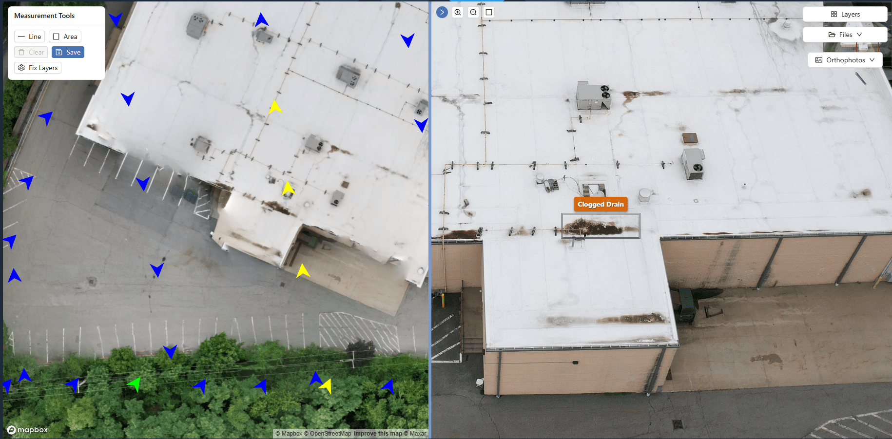
Annotations
Mark roof sections, façade issues, pavement cracks, drainage concerns, or vendor notes directly on the imagery. Notes stay attached to the historical record.
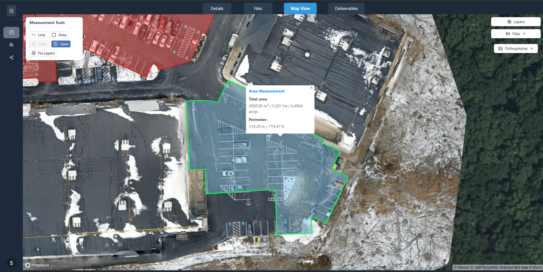
Precision Measurements
Measure roof sections, parking areas, or site distances directly on the imagery. Useful for planning, verification, and documentation.
Recurring Scheduling
Set a consistent capture cadence — 5, 7, 10, or 14 days — so documentation builds over time instead of happening randomly.
Centralized Archive
All properties. All dates. One searchable archive. Even if vendors change, the historical record stays intact.
Sharing & Exports
Share a single clean portal link with asset managers, regional managers, ownership groups, or vendors. Export what you need without reorganizing files.